
Enhancing Mobility
& Connectivity in Hampton Roads
Exploring reliable, efficient access between key destinations and future development across our region
This project is about exploring possibilities
Through community input and technical data, the Naval Station Norfolk Transit Corridor Project team aims to support decisions that will lead to an expansion to the City's existing transit network.
Through the various stages of the project, HRT’s goal is to create an innovative transit plan and environmental impact report that will meet the requirements needed to qualify for future state and federal funding.
The goal of this project isn’t to begin construction, but rather take the proper steps to talk with you and get there.
Project Update - December 2023
In this video, Sherri Dawson, Director of Transit Development at Hampton Roads Transit, is here to give you an important update on the project and explain where we’re heading as the City of Norfolk makes a few key decisions about the future of Military Circle.


Closing Gaps and Creating Connections
We have an opportunity to enhance transportation options across the 757. The purpose of this transit connection is to increase mobility choice, improve access between activity centers and neighborhoods, and help meet the region’s needs for a time-competitive, flood-resilient, sustainable, cost-effective alternative to automobiles.
And the timing couldn’t be better.

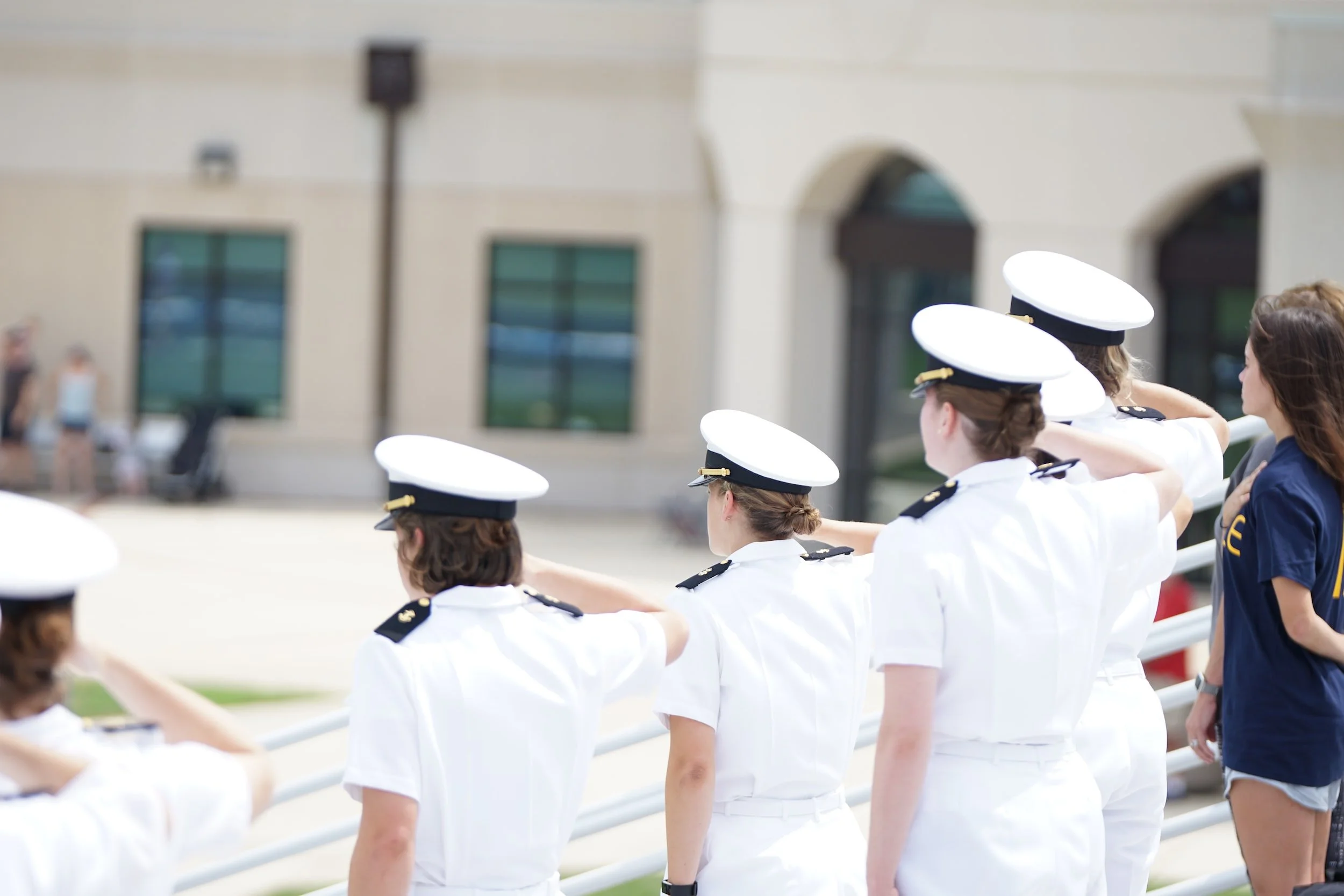
Naval Station Norfolk
A high capacity connection to NSN, the region’s largest employer, is still a top priority for the City and HRT.
A Bus Rapid Transit project serving NSN has potential to compete for federal funding and could connect to the anticipated Chesapeake high-capacity transit corridor.
This could create a regional high-capacity transit network, capturing a larger ridership market for NSN and expanding options for how the transit service could be funded.
A New Military Circle
Military Circle is about to get a makeover. The Norfolk Economic Development Authority (EDA) has received three proposals to redevelop the area into a thriving, walkable district to support an inclusive, healthy, and sustainable mixed-use community filled with thousands of new jobs and places to live.
Enhanced transit access is a huge component of this process
Phase 1
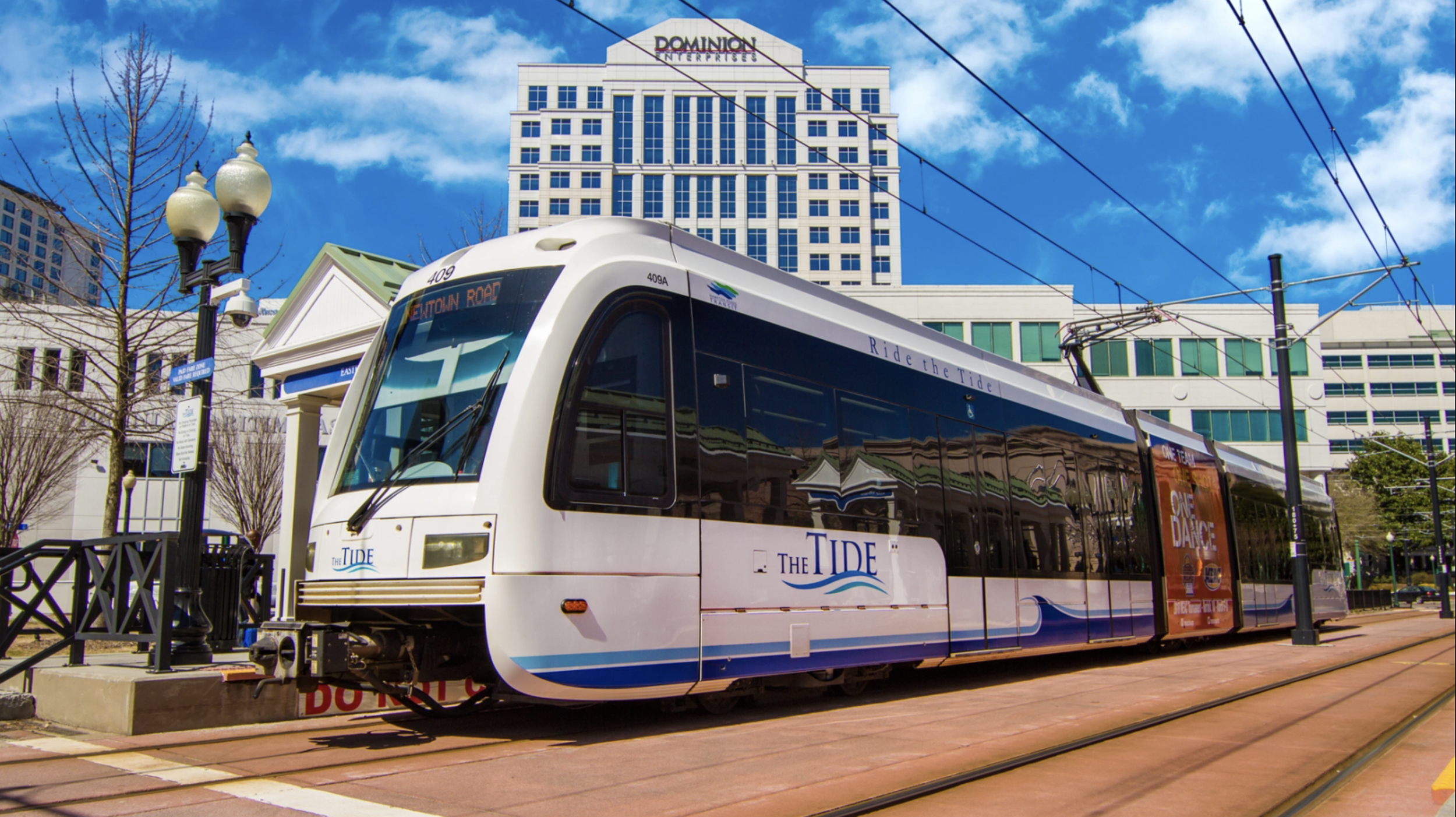
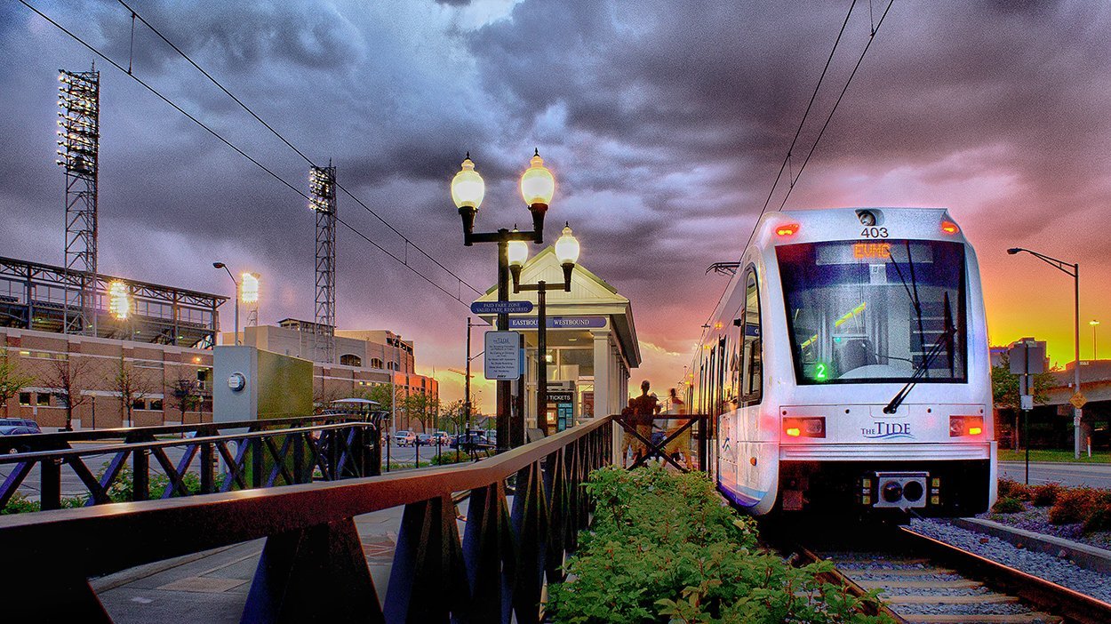
TIDE LIGHT RAIL EXTENSION TO MILITARY CIRCLE
The Phase 1 project would extend light rail approximately 2 miles from its current eastern terminus at the Newtown Road Station to the proposed mixed use development at Military Circle.
The Phase 1 project will include two additional stations: one serving the new mixed-use development and one serving Sentara Leigh Hospital and the supporting medical campuses in the Kempsville Road area.

Environmental Assessment
HRT will complete an environmental analysis for an Initial Recommended Alternative to extend the Tide to the Military Circle Redevelopment Area to move forward into the federal project development process. The 12-month NEPA process is began in November 2022.
Phase 2
EXPLORE BUS RAPID TRANSIT
TO NAVAL STATION NORFOLK
A high-capacity connection to NSN is a top priority for the City of Norfolk and HRT. HRT will further investigate a high-capacity transit connection to NSN that has the potential to connect into a regional high-capacity network.
This will be informed by a study of High Capacity Transit in Chesapeake from the Greenbrier area to Norfolk.
Frequently Asked Questions
-
The intent of the Naval Station Norfolk Transit Corridor Project is to evaluate future transit services for the city’s east side, including service to Naval Station Norfolk. In addition to exploring high-capacity transit options to the Naval base, the study will identify intermediate destinations such as Military Circle Mall, connecting these areas to downtown Norfolk via The Tide Light Rail.
The project is gathering input and data to support decisions that will lead to the selection and construction of an expansion to the City's existing transit network. The cornerstone of this process will be a properly prepared environment impact document, an Environmental Assessment (EA). Through the preparation of an EA, HRT’s goal is to create an innovative transit plan and environmental impact report that will meet the requirements needed to qualify for future state and federal funding..
-
Hampton Roads Transit (HRT), the City of Norfolk, and the Hampton Roads region have identified a need for high capacity transit mobility and connectivity from The Tide light rail system to Naval Station Norfolk. Naval Station Norfolk is the largest employer in the Hampton Roads region and the largest naval base in the world with more than 60,000 military personnel, civilians and contractors. HRT and the City of Norfolk have evaluated initial needs and options within the City, and have determined that a connection along the eastern side of Norfolk would provide for resiliency and redevelopment opportunities to support the City of Norfolk, Naval Station Norfolk, and the Greater Hampton Roads Region.
The project will help to advance the City’s mobility and growth strategies, support regional economic development, support the revitalization of Military Highway Corridor, provide mobility options for commuters, and support military readiness for Navy civilian and military personnel in their efforts to support and protect our country.
-
Fall 2019: Research and Discovery
Public engagement and communications activities were based on the insights and findings from a qualitative and quantitative research effort. Community and stakeholder needs and opportunities identified through the research were integrated into our outreach and overall planning from the outset of the project.
Fall - Winter 2019 - 2020: Project Kickoff and Outreach
The NSNTC Project kickoff meetings provided an opportunity for stakeholders and the public to view initial information about the project history, existing and future conditions, the purpose and need for the project, and provided feedback on an initial set of potential alignments. These meetings also provided information about the Project process and schedule, and educational information about the technology options Light Rail Transit and Bus Rapid Transit. Importantly, this marked the launch of an active community outreach effort that will continued to be conducted throughout the project planning period.
Winter - Spring 2019-2020: Alternative Tier 1 Evaluation
Meetings were held with project advisory committees and community and business groups for Alternative Tier 1 Screening. The project team presented the full set of initial alignments examined, the screening criteria, and the results of the first-tier screening, including the basis for reducing the number of alternatives to carry forward. These meetings provided educational information about the Federal Transit Administration (FTA) Capital Improvement Grant (CIG) program and project justification criteria, as they relate to the evaluation process.
Spring - Summer 2020: Alternative Tier 2 Evaluation
The meetings for Alternative Tier 2 Screening presented the screening criteria and results for the more rigorous evaluation of the reduced field of alternatives. Following the Tier 2 Evaluation, additional analysis was conducted in early 2021 to guide recommendations for the Initial Recommended Alternative.
Summer - Fall 2021: Initial Recommended Alternative
Upon identification of the Initial Recommended Alternative, the project team held public meetings sharing, and also gathering, information about the alternative to move forward into environmental impact analysis. This milestone was an important opportunity to receive information about potential environmental impacts to the remaining alternative to ensure the environmental analysis is thorough and complete.
Spring 2022: Environmental Analysis Begins
In the winter and spring of 2022, the study team considered alignment alternatives for the Initial Recommended Alternative and began preparations for the environmental analysis, Public meetings were held to present the refined Initial Recommended Alternative and to share information about the study’s next steps. These meetings gathered feedback regarding community concerns and project benefits to inform the development of station area plans and environmental impact analysis.
-
The Naval Station Norfolk Transit Corridor project, led by Hampton Roads Transit (HRT), marks a partnership with the City of Norfolk, with active involvement from multiple local and regional partners. These partners have been organized into five working groups:
• Executive Advisory Committee – this committee is comprised of top leaders from business, government and the community who will work closely with HRT and the project team to make final decisions in the planning process
• Stakeholder Advisory Committee – participating members include representatives from leading business, economic development, community service and environmental organizations
• Financial Advisory Committee – this group provides oversight and insights from those with skills and experience in financial management of transit and public works projects
• Technical Advisory Committee – representatives from local, regional, state and federal governmental organizations will lend their expertise to the project
In addition, HRT retained a team led by two veteran transit planning consulting firms who came together for this project by forming Michael Baker-STV Transit JV. Both Michael Baker International and STV Group, Inc. are national engineering, design and architecture consulting service firms that specialize in mass transit and complex infrastructure projects.
The most important partner in the project is YOU. Your involvement is critical in ensuring that recommendations that come out of the study accurately reflect the values of the community, businesses, and neighborhoods within or surrounding the Naval Station Norfolk Transit Corridor project area
-
Through this project, HRT and the City of Norfolk seek to build an even more comprehensive transit network that supports employment centers and residents along the east side of Norfolk from the existing Tide to Naval Station Norfolk. As move through the phases of project development, we want to assess and quantify why we need this expansion, how it will benefit the community and region, and what concerns must be addressed. We can’t do this without the input of you and your community. Every voice matters.
You can get involved in a number of ways. Whether you want to attend one of our community meetings, provide your comments via a short survey, or just send the project team a message, all input is valuable to the team and your voice will be heard.
